Lakes Region Planning Commission

Planning Regionally - Growing Locally

LAND USE PLANNING

Land use, transportation, natural resources, and the social fabric of a community are deeply interconnected. Together, they shape how towns and regions grow, function, and adapt over time. Because of this interdependence, understanding these relationships is essential for informed decision‑making at the local, regional, and statewide levels. When land use patterns shift, whether through new development, redevelopment, or changes in population, those changes directly influence the demand for public services and infrastructure. This includes water and sewer systems, public safety and emergency response, recreational facilities, transportation networks, and building oversight.

Recognizing these impacts, the LRPC collaborates closely with its member communities to support thoughtful, future‑focused planning. This work includes preparing comprehensive land use studies, developing targeted area or corridor plans, conducting build‑out analyses, and assisting with a wide range of local and regional planning initiatives. Through these efforts, the LRPC helps communities make coordinated, well‑informed choices that balance growth, resource protection, and long‑term resilience.

Regional Plan

See Regional Planning page.

Master Plans

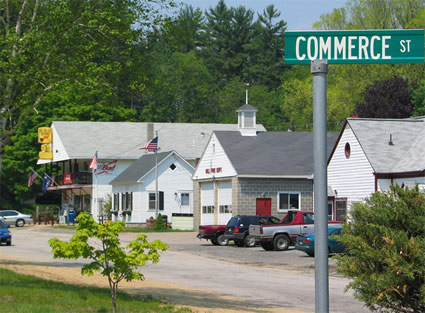
A master plan is a municipal document that acts as a roadmap for the future; it guides local officials when they are making decisions on budgets, ordinances, capital improvements, zoning and subdivision matters, and other growth-related issues. A master plan shows current conditions and trends while providing community leaders an opportunity to look ahead, establishing new visions and goals that represent the needs and desires of the residents.

Resources:
          RSA 674:2
          Preparing a Master Plan for Your Community (2004)


LRPC has assisted in the development of many master plans within our region. Recent efforts include working with the towns of Holderness, Moultonborough, Sanbornton, Sandwich, and Tamworth through HOP (Housing Opportunity Planning) grants and the town of Holderness with updating their entire master plan.

Capital Improvement Programs (CIP)

A Capital Improvement Program is essentially the financial counterpart to a community’s master plan. It functions as a planning and decision‑making tool that identifies and schedules major town improvements over a minimum six‑year period. By doing so, it connects long‑term planning goals with the practical budgetary realities of delivering municipal services.


According to RSA 674:5, the primary purpose of a CIP is to “aid the mayor or selectmen and the budget committee in their consideration of the annual budget.” The document outlines a recommended timeline for funding and completing necessary capital projects.

As an advisory plan, the CIP is intended to guide the broader direction of the municipality’s capital spending. It is not meant to impose strict annual spending requirements, but rather to help inform and shape future budget decisions.


LRPC has assisted in the development of CIPs for Belmont, Hill, Meredith, Northfield, Tilton.

Zoning Ordinances

Zoning is the process a community uses to regulate how land, buildings, and structures may be used, based on the policies outlined in the Master Plan. Rather than being viewed as restrictive, zoning should be understood as a constructive tool that guides desirable development, protects existing community character, and supports growth that aligns with local traditions and long‑term goals. In this sense, zoning serves as a practical mechanism for carrying out the Master Plan. It is derived from the Plan and helps translate its recommendations into action. As a result, a zoning ordinance functions as a land‑use planning tool that shapes the future development and preservation of the community. Resource: RSA 674:16.

Subdivision Regulations

The overall purpose of subdivision control is to ensure that new development within a municipality occurs in a planned, orderly, and responsible manner. These regulations are intended to safeguard future residents and existing neighboring property owners from issues that arise when land is divided or built upon without proper design, coordination, or infrastructure. By setting standards for layout, access, utilities, open space, and environmental considerations, subdivision control helps create safe, functional, and sustainable communities. In doing so, it also supports the broader objectives of the municipality’s police power, promoting public health, safety, convenience, and general welfare through thoughtful land‑use management. Resource: RSA:674:35

Site Plan Review

A site plan is a document that may need to be submitted to the planning board before any development takes place on a specific parcel of land. It illustrates the proposed placement of buildings, parking areas, landscaping, drainage systems, and other improvements on the property. It also shows how these elements relate to existing site conditions, including roads, nearby land uses, natural features, public facilities, access points, internal driveways, and similar characteristics.


Site plan review is one of the most effective tools in contemporary land‑use regulation. It ensures that developments permitted under the zoning ordinance are designed and constructed in a way that fits appropriately within their surroundings. This process helps prevent issues related to drainage, traffic flow, lighting, and other potential impacts on the surrounding area. Resource: RSA:674:43

Development of Regional Impact (DRI)

A development of regional impact occurs when a proposal submitted to a local planning board, zoning board, land‑use authority, or historic district commission has the potential to affect one or more neighboring municipalities. Under N.H. RSA 36:54 through RSA 36:58, a project is considered regionally impactful when its scale, location, or characteristics could reasonably be expected to produce effects beyond the boundaries of the community in which it is proposed. These effects may relate to traffic, environmental resources, public services, shared infrastructure, cultural or historic assets, or other regional considerations.


For additional guidance on how to identify, evaluate, and formally designate such developments, please refer to the Lakes Region Planning Commission’s Regional Impact Guidelines. These guidelines were approved by the Commission on September 24, 2018, and remain in effect today, providing a detailed framework for local boards to make consistent and well‑supported regional impact determinations.

Housing Needs Assessment

See our Housing page and the 2023 Lakes Region Housing Needs Assessment adopted by the Commission on October 23, 2023.

Publications & Resources

NH Municipal Association Webinar “The Workings of a Planning Board” (07/20/23)
          ​Webinar Recording | Presentation Slides

NH OPD Planning Lunches at Noon (PLAN) Webinar “Navigating the Planning and Zoning Board Handbooks: What’s New in the 2022 Edition?” (02/16/23)
          Webinar RecordingPresentation SlidesWebinar Chat

Handbooks
          The Planning Board in New Hampshire – A Handbook for Local Officials (updated 2023)
          The Zoning Board of Adjustment in New Hampshire – A Handbook for Local Officials (updated 2023)
          Federal and State Planning and Zoning Case Law for New Hampshire Local Officials (updated 2023)

Housing and Conservation Planning Program (2007)

Copyright © 2025 lakesrpc.nh.gov | All Rights Reserved